Sunday, July 31, 2011

Churchill Falls


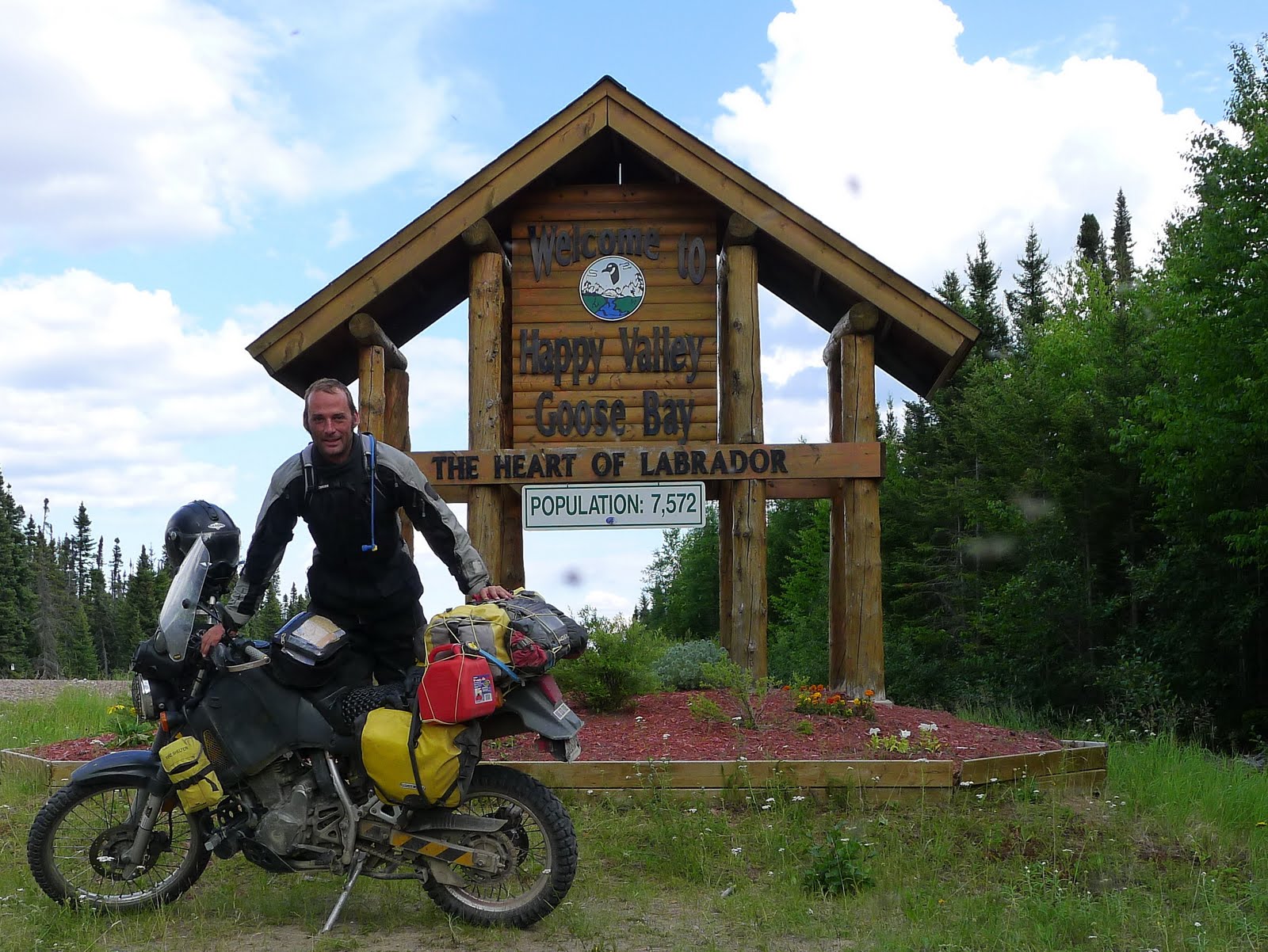
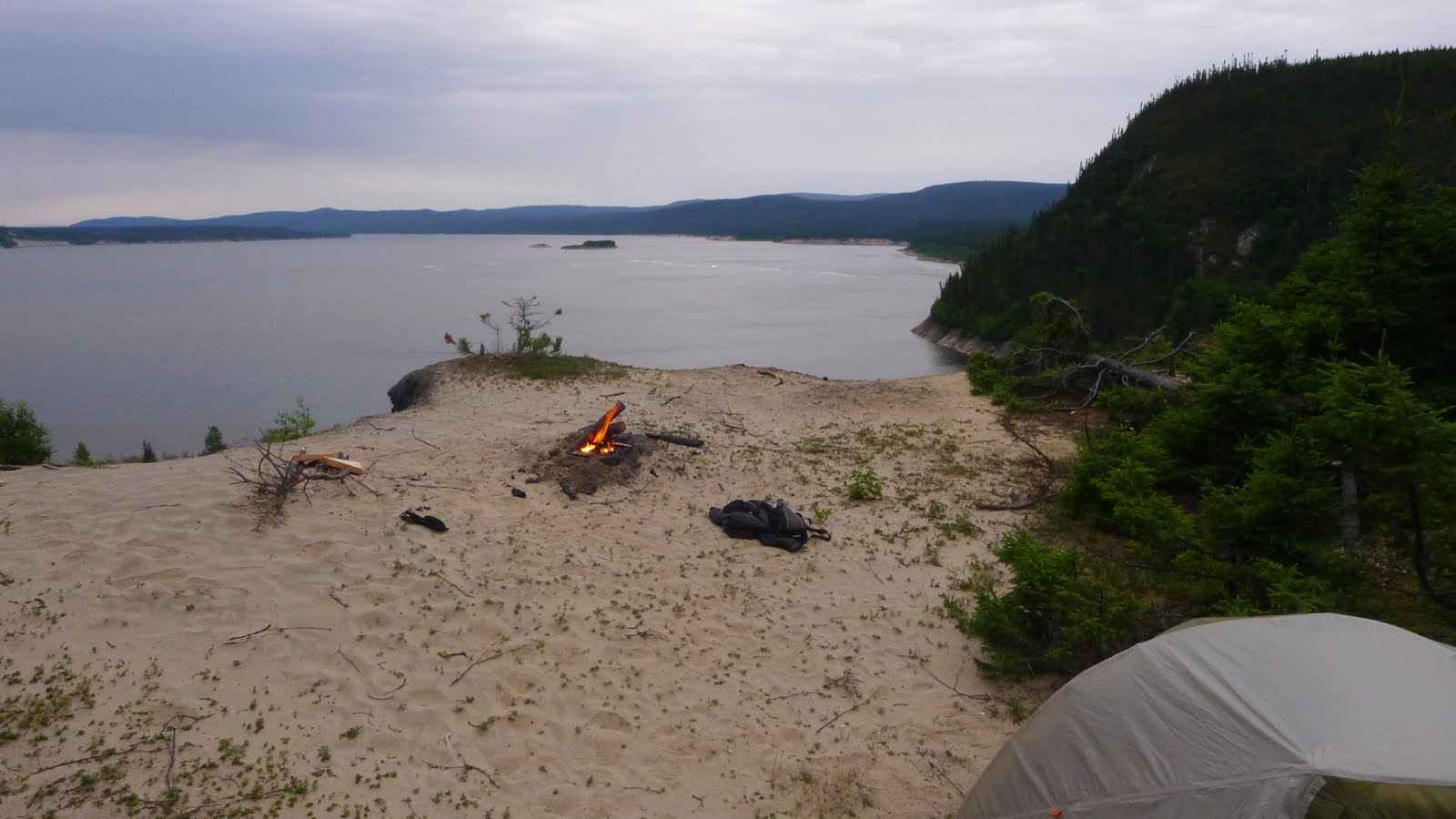
Had a bit of trouble leaving Goose Bay. The bike started surging oddly, and my first thought was to check the chain to see if I'd broken yet another one, but it was fine. The second time I stopped to check the bike, I noticed that one of the engine mounts had rattled loose, so I doubled back to town to get a replacement bolt. After some shoddy mechanical work in the parking lot of an Ace Hardware store (which, it should be noted, had neither metric fasteners nor a 9/16" wrench) I was back on the road. I needed to see Muskrat Falls, and by the time I was done there, I decided to just camp nearby at a nice spot overlooking a lake.

Yesterday I stopped again at Gull Island, which was accessible only via a long dirt road, where I dropped the bike in a series of deep ruts, then more gravel road to Churchill Falls.


Churchill Falls is a weird place-- suburbia recreated in the wilderness. I'm sitting in the town's only restaurant, which shares a building with the town's hotel, supermarket, library, post office and school. They tell me there is also a curling rink and a theater in here.

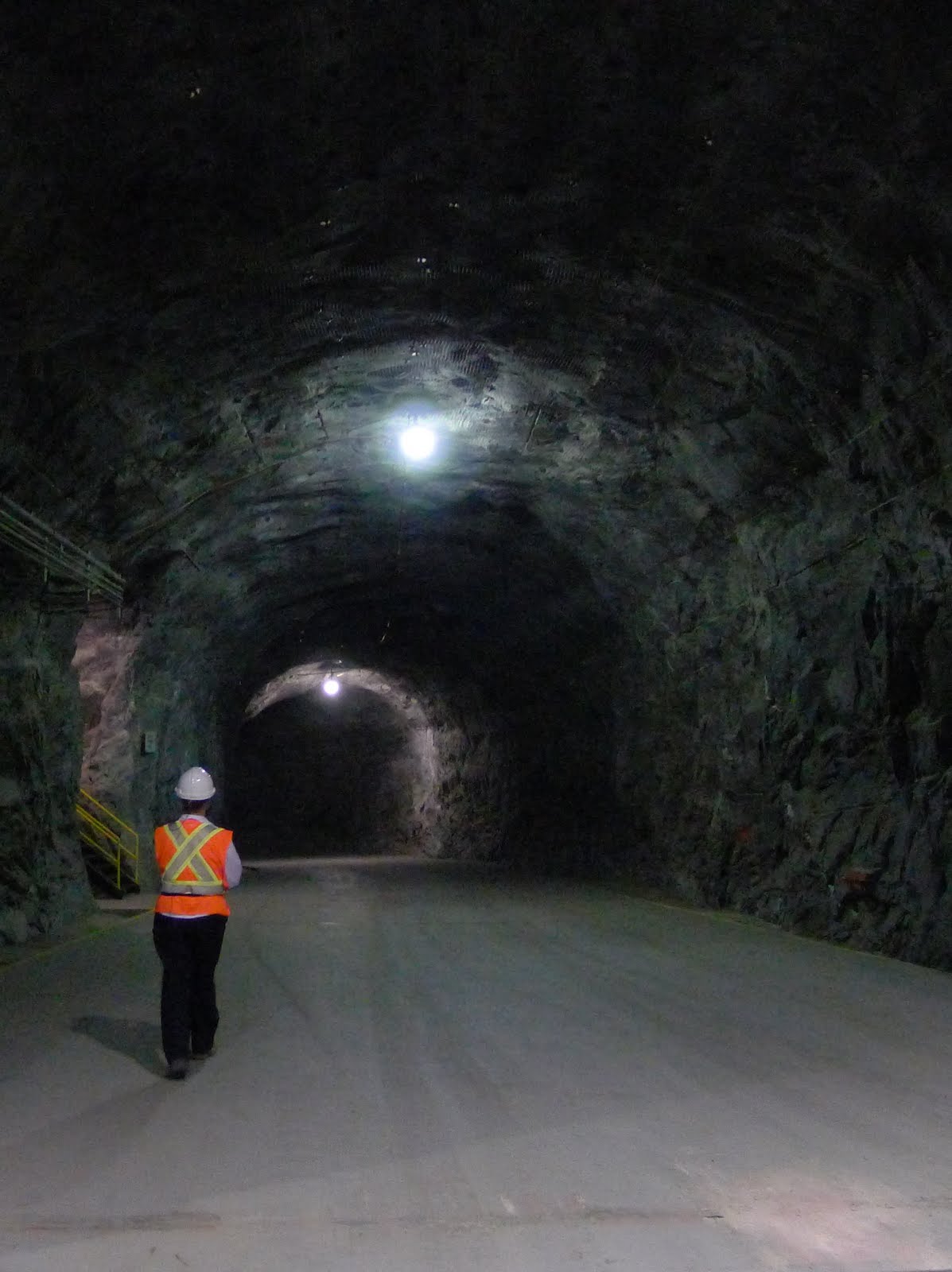
Every building in the town, with the exception of the pub, convenience store, and gas station, are owned by Nalcor, the company that runs the electrical generating station here, powered by what used to be the town's namesake waterfall. The river has been diverted into a huge series of tubes that run 91 stories down into a granite mountain, where the water turns 11 turbines that work like the alternator in a car to generate electricity for Quebec, Nova Scotia, and the Eastern United States.


I spent yesterday evening at the pub,which was filled with workers from the road crews. They're a rough bunch, coming from other parts of the province to spend four months on, two months off blasting rock and resurfacing the highway, and they live in a camp outside of town.


Craig, a quiet fellow with a glass eye, who sat in the corner nursing a Jack and Coke, told me starting pay on the road was $85,000. With nothing to spend their money on, they come into town to get plastered. Christa, one of the bartenders, was fending off the advances of a particularly persistent young road worker, which I gathered was a nightly occurrence. Craig shared my view that Churchill Falls gave off a weird vibe, but Jessica, the other bartender, grew up here and loves it. Her graduating high school class had 17 people in it, in a school of 130 students total. She said she'll be sad to leave in a few years, when her father retires. Once you stop working for Nalcor, you have to go.

I spent the night down at the beach, which was nice, but I didn't zip the tent all the way closed, and there were so many mosquitoes inside when I woke up that it was like a horror movie.

The Innu guys I was talking to in Sheshatsiu were talking about a shortcut you could take to James Bay in Northern Quebec from here. I was intrigued, until I found out what they meant. Just west of Churchill, there's a dirt road leading to a train station in Esker, which is how they brought the huge transformers to the power station before the highway went through to Lab City. The shortcut is taking the Esker Road, then riding the active railway tracks north. It's still a little tempting, but I'm going to stick to the road.

Okay, looks like the weather is clearing up nicely. Time to hit the road for Lab City and parts unknown.

Ever forward.

Friday, July 29, 2011


I broke my one rule again last night-- the one about setting up camp early-- but it was for a good reason.
 From Goose Bay I headed north for a side trip to Northwest River. Less than half an hour from Goose Bay, Northwest River is a tiny town that was the home for the Hudson Bay Trading Company. It's also where Leonidas Hubbard left on his ill-fated expedition. the museum there had a large collection of things from the expedition, including his last meal-- a boiled shoe.

Just about everyone I spoke to in Northwest River offered me a place to stay, actually, the first was a motorcycle rider in Goose Bay as I was leaving the hotel. Joey was on a cruiser, and I asked him how he gets anywhere on his bike without the whole dual sport suspension and dirt tires. He said he didn't go anywhere far, just Goose Bay and Northwest River and the immediate area. I said goodbye and went to get gas, and Joey roared up next to me to tell me he had a place in Northwest River and I could camp there.

The other place I wanted to see was the Innu town of Sheshatsiu. It's connected by bridge to Northwest River (an improvement over the single cable  car they used until the early 1980's). I was hanging out there and got invited to take part in a sweat lodge ceremony. I'll write more about that later, but the three guys doing it were incredibly welcoming, explaining everything as it happened, and I felt pretty lucky to be invited. It was an important ceremony for Mike, who is about my age, because he was receiving his pipe, and Jack, a young shaman, had come down from James Bay to perform the ritual. Max, a shaman who lives in Sheshatsiu rounded out the group, along with yours truly, playing the part of clueless white guy, which I felt I did well.

The heat was pretty brutal, and we emerged from the sweat lodge at about midnight. I didn't want to disturb any one the folks who had invited me to stay with them, so I headed for Joey's vacant spot on the beach. The only problem was the bear.

All day long, people had been talking about the three bears who had wandered into town a few days before. Two of them were found and shot (for meat or public safety, I am uncertain). While they hadn't located the third bear, it was last seen wandering around (you guessed it) by the beach.

A large white dog was sleeping on Joey's porch when I showed up, which I took as a good sign, because it would probably bark if a bear showed up (although, come to think of it, it didn't bark when I showed up...). I put the food, in it's bear-proof canister, along with my stove, on the other side of the lot, brought my bear-spray into the tent with me, and left the radio playing as I drifted off to an uneasy sleep.

The next morning I headed back across the bridge to Sheshatsiu to speak with a tribal elder there, a woman who grew up in the bush, camping and hunting. The first question she asked me was "Weren't you worried about the bear?"

I guess the animal spirits were on my side. Maybe I didn't bungle the ceremony as badly as I thought.

Anyway, I'm off towards Churchill Falls, back on the gravel.

Wednesday, July 27, 2011

Why go to Cartwright?


Everywhere I've gone, starting on the ferry, people have either questioned my desire to go to Cartwright or casually mentioned that it's about 100 miles out of the way. Since I've already come several thousand miles out of my way for no good reason, I wasn't persuaded.

I did have a vague, work-related reason for going there,  but really I just wanted to see it. It's as far north as you can get on the East Coast on roads. Any farther and you need a float plane or a boat.

It's also a town in decline. Now that the road from Goose Bay to Port Hope Simpson is complete, you don't need to take the ferry through Cartwright anymore. There are no scheduled flights from the airport anymore. The town of about 600 people is hurting, everything is closing down, including one of the town's two restaurants.

I talked to a few of them, and some see hope in the planned opening of Mealy Mountain as a national park. It's supposed to be about 11,000 km of wilderness set aside for preservation, which could give Cartwright a new purpose as a travel destination. I sure hope so, because the people I met there were some of the nicest anywhere.

After asking around a bit, I set up camp down on a public beach. Pat, who lived in the nearest house, came down with his son Marcus and we chatted a bit --Pat said there were usually whales at this hour, but my wildlife luck held true, and I saw nothing-- then I watched the sun set over Sandwich Bay.

Next day, I ate more delicious bakeapple jam at the Cartwright Hotel, and loaded up on gas for the next stretch of highway-- the longest-- from Cartwright to Goose Bay.

Oh, a little more about the road. Pat, my friend from the beach, works on the grader. As I was leaving Cartwright I passed him, and we honked and waved. I tried not to hold it against him, everyone has to make a living, but the fact is the grader is the natural enemy of the Trans Labrador motorcyclist.

Forget what I said about the stretch of the highway from Red Bay to Port Hope Simpson being the worst. The people who told me that were liars. The worst section of the highway is wherever the grader has done its evil work.

The subsurface of the highway is some kind of gypsum, I think, but it resembles concrete. Over top of that is gravel. The grader goes through, scraping all the gravel into the center-- first one side, then the other, and those patches are like pavement, except for the pile of gravel in the center, maybe 8 inches high. You don't want to cross that at anything less than a 90 degree angle-- it will put you down fast, but it's not the worst thing.

The final part of the grading operation is to spread the gravel out again, which leaves a surface that a motorcyclist in Red Bay described well, as "like marbles on terra cotta." These sections are treacherous, but you know they're coming up when you see the grader doing its dark business.


Nonetheless, after a hot and dusty five or six hour ride, I arrived in Goose Bay exhausted, and booked a hotel room. This place is lousy with motorcyclists, mostly a group from Ontario. My South African friend passed through here yesterday, they tell me. I'm going to hit nearby Northwest River and Sheshatshiu tomorrow. A fellow at Battle Harbor tipped me to a campground near there that he stayed at for quite a while. I fell asleep almost as soon as I got here, now I think I'm going to go get a beer. I feel I've earned it.

Tuesday, July 26, 2011

Red Bay to Battle Harbor


Just a quick note on the road before I set off again.
Supposedly, I've now done the worst part (not the longest stretch, but the worst road surface), and it wasn't that bad. Washboard, potholes, loose gravel over a hard base. Apparently the thing to watch for is the graders, who push the gravel into the center in a deep pile, so that it's then shoved outward again by the passing trucks.

The black flies are pretty bad. Saw a woman yesterday walking two dogs near L'Anse au Clair, and all three were wearing bug jackets.

Saw the oldest documented burial ground in North America, stayed the night in Battle Harbor. It was about the same as a hotel, but for that you got a ferry ride and two meals. I stayed in the dormitory-style "bunkhouse" building out there, but it was all mine, so I charged my cameras and phones, watched a movie on the netbook, and took a lot of pictures.

Okay, off to Port Hope Simpson, then Cartwright.

Sunday, July 24, 2011

Labrador starts...


Labrador starts, or at least it did for me, with an air hockey table at the Northern Lights Inn bar. There's also a billiards table, and one of those sand bowling things like the one they have at the Mount Royal Tavern in Baltimore.

I'm sharing a campsite across the street with a retired South African dentist who has ridden motorcycles through places I haven't even heard of. We met on the ferry from St. Barbe to Blanc Sablon, hanging out with the publisher of a Canadian motorcycle magazine and his friend, who are here testing out a new bike.

I had reservations for the 3:30 ferry, which left at 6, thanks to a wind and rain storm we all battled through on the way to the terminal. It was a bad wind. Not Kansas bad, but unpredictable. It first hit me while I was passing a car at a high rate of speed on a two lane highway between L'Anse aux Meadows and St. Barbe. The bike wobbled dramatically, then back as I over corrected. I think the people in the car were more scared than I was. They passed me later when I stopped for gas, and when I caught up again, they just got off the road.

The rain started sometime last night , and it was a cold one, so this morning was spent in the laundry room at the Viking RV Park, trying unsuccessfully to dry out. It worked well enough to prevent hypothermia, but I wouldn't call the ride to the ferry comfortable. The rain and the wind were enough to make me forget about constantly scanning for moose, and I guess I was lucky. One of the other ferry passengers had a close encounter in his car that left him pretty shaken.

Anyway, the ferry ride was uneventful, spent telling motorcycle travel stories. I'm posting this from the Northern Lights' lobby, before I head back to show the South African what snoring sounds like. The late ferry just got in, and with it the trio of Russian ladies, who I was happy to see because I felt a little bad not saying goodbye.

I'm headed for Cartwright, partly because there's a giant iceberg up there to see, but partly because it is a town in an interesting state of affairs. Before the Trans-Labrador Highway was completed, you had to take a ferry through Cartwright, so there was a tourist trade. Last year they finished the highway, so Cartwright isn't on the route anymore.

Anyway, I probably won't make it there tomorrow, because there's a lot of stuff to see down here, as the bartender just told me.

All for now.

Saturday, July 23, 2011

Gros Morne to L'anse aux Meadows

I'm running behind on this, but I screwed around quite a bit between Gros Morne and L'Anse aux Meadows. Here are a couple of the things I saw.


Port-aux-Basques to Gros Morne


It started raining lightly as the ferry docked, and I headed up the coast, intending to make it somewhere near Corner Brook to camp. I made the same mistake I've made about a million times, though, of continuing on past where I should have stopped. So I was in Corner Brook, campsite-less, where the light rain turned into a torrential downpour. I tried to set up the tent on a closed-off road off the main highway, but it filled up like a bathtub. Finally, I gave up and rode around in the rain, mostly blind, looking for a hotel and watching for moose. By the time I found the hotel, they told me the entire city of Corner Brook was booked solid, but a guy at a bed and breakfast had just had a cancellation. I was soaked to the bone and miserable, so I took it. And that is how your humble narrator showed up at the romantic Bell's Inn after midnight, probably waking up everyone in the place, to spread wet motorcycle gear over the antique furniture to dry. It cost $110 I really didn't want to spend, but at that point staying on the road seemed suicidal, and the owner Gord was a nice guy. I got some funny looks from the vacationing couples in the morning, and headed out after breakfast.

The next day was wonderful, sunny and a bit cold. I made it to Gros Morne park at around noon to make sure I had a campsite, intending to check out the park. It had warmed up by the time, so I hung the gear up to finish drying and explored Green Point. The beach here is made up of boulder-sized rocks, and down the beach there is a summer fishing village consisting of a few huts and a couple of what I would call marine railways, but they're made of logs lashed together. Just beyond that, on Green Point itself, as an area of shale rocks that were used to define the boundary between the Cambrian and Ordovician periods of geologic time (or that's what the bronze plaque told me, anyway). What all this boils down to is that I have a lot of pictures of rocks.

This morning there were whales in the bay, or so my neighbor Trish (from Arlington, Va) told me. When I got up they had moved further out, and I would have thought they were more rocks. I turned on the computer to back up my pictures, and found that the camp's wifi connection actually worked, so here we are.

Today I continue up the viking trail, headed for L'anse-aux-meadows and the next ferry.

All for now.


PS-- I keep forgetting to say hello to Ellie, Christian and Matthew. Hi guys! I hear you made it back to London. Hope you're following me on the map! -Uncle Chris

Thursday, July 21, 2011

Whiskey for breakfast


Yesterday started right, with a tour of Glenora, Canada's only single malt whiskey distillery. Unfortunately, the whiskey costs about a million bucks a shot, so the sip I got on the tour had to suffice.
From there it was on to the Cabot Trail, which has replaced Highway 1 north of San Francisco as the best mtorcycle road I've ever been on (sorry, Goose). Miles and miles along the coast of Cape Breton, and if this free internet kiosk would let me, I'd post a picture or two. Don't worry, I'll add them later (note: added later).

Made it to North Sydney last night around 8, camped in a campground a couple of miles from the ferry. Three very nice Russian ladies (actually, one of them was a very nice Polish lady, but they were all from Toronto anyway) had the camp site next to mine, and we stayed up talking until midnight, me telling them about my trip, them telling me about life in the Soviet Union. They're headed to Newfoundland in their minivan, with a possible side trip to Labrador. Actually, they're on this ferry somewhere.
At the grocery store this morning I met a fellow from Quebec who had just finished the Tran-Labrador Highway. On his bicycle. Said it took about a month, I believe. There's always someone who is doing something more ridiculous thn whatever enterprise you're engaged in.
Oh yeah, the ferry. I made it to the first of two scheduled events for this trip-- the ferry from North Sydney to Port-aux-basques. We haven't left the dock yet, but this thing is like a cruise ship. The motorcycle is belowdeck, strapped to the sole. You ride it on and they point you to a bucket of straps. We'll see how much I've retained from my sailing experience if the bike's still standing at the end of the trip.
Anyways, I'll be on this boat for the next six hours or so, then I'll be in Newfoundland. The next thing on the schedule is the ferry to Labrador on the 24th, then pretty much nothing.

*Edited to add:
If that seemed to end a little abruptly, it was because I was interrupted by a little girl saying "Where's all this water coming from?" It was coming from my camelback on the floor, which had chosen that moment to leak all over the place. I hit send and went to find someone to tell. They were very nice about the whole thing, but I stayed out of the computer room after that.

Tuesday, July 19, 2011


Made it across the border this morning with a minimum of discomfort (she wanted to see my bear spray, I got a little nervous when she filled out a plastic bag marked "evidence," but neither of us spoke of it, and the moment passed). Spent a lot of time trying to figure out how to call home (solution: Google Voice, plus WiFi), then headed out, on the advice of a woman at the Visitor information center, on route 6 along the north coast of Nova Scotia. I've already completely lost track of what day it is, and after taking it easy today, I realized the ferry tickets I thought were for Friday are actually for Thursday. So tomorrow I'll try to hit the Cabot Trail and end up in North Sydney, maybe sleeping at the marine terminal parking lot, so I don't miss the boat.

All for now.

Woah-oh New England

Made it through Maine, and stopped for a while to see my friends Tom and Dayle, their two kids, and their aviary. Finally got off I-95, and took a route Tom suggested to Calais, where I camped for the night.

In honor of yesterday's passage through New England, here  is a brief list of unsuccessful names for cutesy New England Shoppes. Feel free to add your own in the comments

Maine-ly Botulism
Heil Antlers
Indian Burial Grounds (Coffee Shop)
Puri-TANNING
Sid's World of Falconry

Sunday, July 17, 2011

Whimpering and postponing...

"Henceforth I whimper no more, postpone no more, need nothing."
-Walt Whitman

I really love that poem, but the truth is I still whimper and postpone, and I need an awful lot of stuff.

Got a late start today, so I'm posting this from Salisbury Beach, Massachusetts. At least I'm north of Boston for tomorrow's rush hour. As far as I know, Maine and New Hampshire have no rush hour, because, well, where would they go?

Not much to report. Successfully dodged a thousand deaths on I-95 and associated thruways, thought about stealth camping in an abandoned minigolf course, then decided that might anger the tiny Mayan gods who probably lived in the miniature temple, so I'm at a campground, where everyone seems to be out getting liquored up so they can come back and make a bunch of noise later.

The bike did well, everything seems to be working and, surprisingly, not overloaded.
Other than that, not much to report.

Okay, I'm off


Getting a late start today, so this'll be brief.

Yesterday I went back to school-- Adventure Riding School, that is. It was a free thing sponsored by Bob's BMW, which they let me attend, despite the fact that I do not own a BMW (and there was a minimum of teasing). I met a bunch of nice folks from ADVRider.com, and I'll let them tell you about what happened at the school, because I've got a long way to go on I-95.

I feel like I'm bringing to much stuff, and also that I'm forgetting something important.

Ever forward.

Tuesday, July 12, 2011

A Great Unknown Land

Leonidas Hubbard, Moustache-wearer
"A great unknown land right near home, as wild and primitive to-day as it has always been! I want to see it. I want to get into a really wild country and have some of the experiences of the old fellows who explored and opened up the country where we are now."
-Leonidas Hubbard, November 1901


It's that time of year again, when I shirk all my responsibilities to head off for a motorcycle adventure. Some of you may have read the last installment, Across America By Motorcycle, wherein my intrepid companion Rod and I set off to trace the route taken by C.K. Shepherd in the book of that name. Well, the bike and I are a little older, not much wiser, and we're heading off to explore "the land that God gave Cain," exotic Labrador. I'll take the Trans-Labrador Highway, starting from Newfoundland, and looping through the sub-arctic back down to Quebec, where I hope meet up with Rod somewhere around Toronto. I'll be camping along the way, and taking time to see the sights. You can see the route I'll follow at the right, and above that, once I actually leave, there's a map that will track my position.

I am not the first tourist to make a sightseeing trip to Labrador. That honor goes to Richard Hore, who set out from England in 1536 with a boatload of young nobles to see the New World. Thirty of them signed up for the trip, along with ninety professional sailors and fishermen. They took two boats, one of which sailed back home laden with cargo. The other, which happened to be the one the young lords were on, grounded somewhere between Newfoundland and Labrador after being attacked by natives, or so they claimed.

The real story, it seems, came out after their return aboard a hijacked French ship. Contact with the Beothuk who inhabited the region had been limited (they had run away at the Englishmen's approach, leaving some bear meat on the fire). Unable to feed themselves, the gentlemen turned to cannibalism until the hapless French vessel landed close enough to be stolen. The nobles' straits may have not been as dire as they thought-- the French sailors fixed the boat up, and sailed to England to demand payment.

Hore set a high bar for incompetence (or at least bad luck), but Leonidas Hubbard, a writer for the outdoor magazine Outings, whose words begin this entry, took things to extremes, and I hope to capture some of his boundless enthusiasm. As he wrote in his final diary entry, found later by his companion, "I think death by starvation is not so bad."