

Everywhere I've gone, starting on the ferry, people have either questioned my desire to go to Cartwright or casually mentioned that it's about 100 miles out of the way. Since I've already come several thousand miles out of my way for no good reason, I wasn't persuaded.
I did have a vague, work-related reason for going there, but really I just wanted to see it. It's as far north as you can get on the East Coast on roads. Any farther and you need a float plane or a boat.
It's also a town in decline. Now that the road from Goose Bay to Port Hope Simpson is complete, you don't need to take the ferry through Cartwright anymore. There are no scheduled flights from the airport anymore. The town of about 600 people is hurting, everything is closing down, including one of the town's two restaurants.
I talked to a few of them, and some see hope in the planned opening of Mealy Mountain as a national park. It's supposed to be about 11,000 km of wilderness set aside for preservation, which could give Cartwright a new purpose as a travel destination. I sure hope so, because the people I met there were some of the nicest anywhere.
After asking around a bit, I set up camp down on a public beach. Pat, who lived in the nearest house, came down with his son Marcus and we chatted a bit --Pat said there were usually whales at this hour, but my wildlife luck held true, and I saw nothing-- then I watched the sun set over Sandwich Bay.
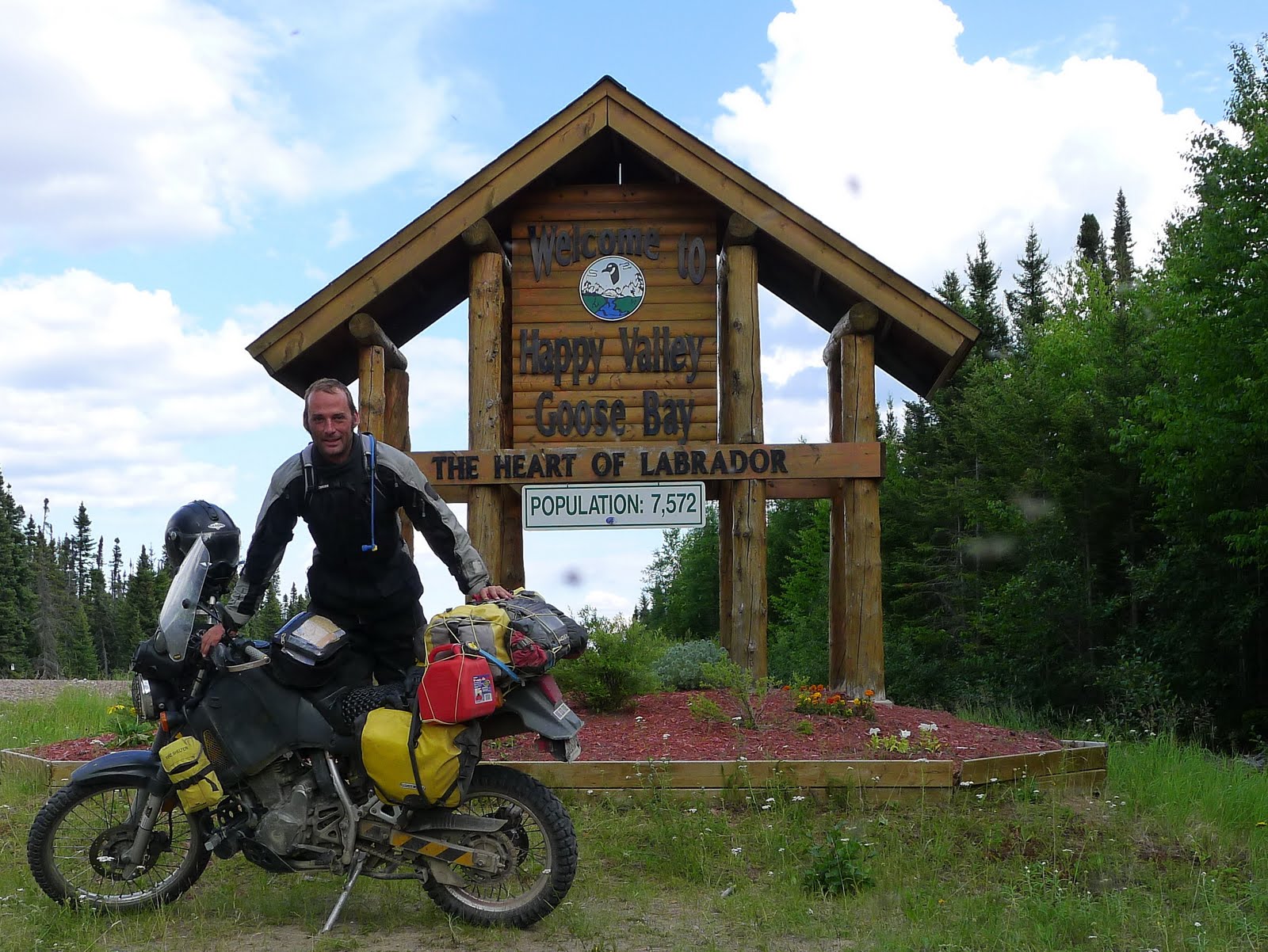
Next day, I ate more delicious bakeapple jam at the Cartwright Hotel, and loaded up on gas for the next stretch of highway-- the longest-- from Cartwright to Goose Bay.

Oh, a little more about the road. Pat, my friend from the beach, works on the grader. As I was leaving Cartwright I passed him, and we honked and waved. I tried not to hold it against him, everyone has to make a living, but the fact is the grader is the natural enemy of the Trans Labrador motorcyclist.
Forget what I said about the stretch of the highway from Red Bay to Port Hope Simpson being the worst. The people who told me that were liars. The worst section of the highway is wherever the grader has done its evil work.
The subsurface of the highway is some kind of gypsum, I think, but it resembles concrete. Over top of that is gravel. The grader goes through, scraping all the gravel into the center-- first one side, then the other, and those patches are like pavement, except for the pile of gravel in the center, maybe 8 inches high. You don't want to cross that at anything less than a 90 degree angle-- it will put you down fast, but it's not the worst thing.
The final part of the grading operation is to spread the gravel out again, which leaves a surface that a motorcyclist in Red Bay described well, as "like marbles on terra cotta." These sections are treacherous, but you know they're coming up when you see the grader doing its dark business.

Nonetheless, after a hot and dusty five or six hour ride, I arrived in Goose Bay exhausted, and booked a hotel room. This place is lousy with motorcyclists, mostly a group from Ontario. My South African friend passed through here yesterday, they tell me. I'm going to hit nearby Northwest River and Sheshatshiu tomorrow. A fellow at Battle Harbor tipped me to a campground near there that he stayed at for quite a while. I fell asleep almost as soon as I got here, now I think I'm going to go get a beer. I feel I've earned it.

Well Done Chris! The road condition reports are invaluable. Looks like the surface can change suddenly and without much warning.
ReplyDeleteI'm expecting to do a lot of camping on that leg of my trip and hoping I can find places without too much difficulty. I made no hotel or B&B reservations.
Keith, you can camp almost anywhere out here, just ask around. I didn't make any reservations either.
ReplyDelete